Tuesday 28 August 2018

Kate and Sandy’s Epic Road, Part 2


Day 3: Shoal Lake, MB to Winnipeg, MB

After a good sleep, we pulled out of Shoal Lake and had a very brief stop in Gladstone for a classic photo-op.  Those of you who have followed our blog since Sandy’s 2008 cycle trip across Canada, may recognize the local icon beside which we are photographed.
Gladstone - Happy Rock
Get it?😀


We then continued the short hop into Portage La Prairie where we met our friend, Heather, from the GASP ride. She lives in an old house with the most amazing inlay hardwood floors, “the reason I bought the house,” she told us. Don’t ask me why I didn’t take a photo of the beautiful craftsmanship in her home. After a nice lunch together and a brief visit, we said our goodbyes and carried on to Winnipeg.


St. Vital is the Winnipeg neighbourhood in which Sandy grew up. We made our way to its beautiful municipal park, set out our chairs, had a little snack, and then went for a nice walk in the park. There are trails through stands of oak trees, a duck pond, toboggan run (well, in winter, that is), picnic areas, and a beautiful garden with gorgeous flowers of types I have never seen before.  There is a Peace Pole in the garden.  All Peace Poles have the inscription “May Peace Prevail on Earth,” in the language of the country in which it is located as well as a number of other languages.  Since first conceived in Japan in 1955, over 100,000 Peace Poles have been erected in over 180 countries.
Autumn colours already starting at the duck pond

St. Vital Gardens
Peace Pole, St. Vital Gardens


Just next door to the park lies the St. Vital Cemetery. How could Sandy be so close and not pay a visit to her Mom and Dad?  She wasted no time in letting her brother, John, and sister, Cathy, know she had visited their parents, and bragged that this made her their parents favourite!
Never too late to score points with Mom and Dad


The next item on our agenda was dinner at a terrific little Vietnamese restaurant we discovered when in Winnipeg two years ago. We were so impressed, we gave it our very first Yelp review. Mark our HUGE disappointment to find it was closed for the month!  Not to worry, though, Sandy’s favourite pizza place, Gondola Pizza, was just down the street.
Sandy very happy to get her favourite pizza 


After dinner, we headed south of Winnipeg to Sandy’s brother John’s acreage at Niverville where we spent the night. John’s “retirement” job is long haul trucking. I couldn’t resist literally climbing up into the cab (John had to give me a boost) and pretending to drive it. What a machine!
Kate "driving" John’s truck


Day 4:  Niverville, MB to Birds Hill Provincial Park, MB

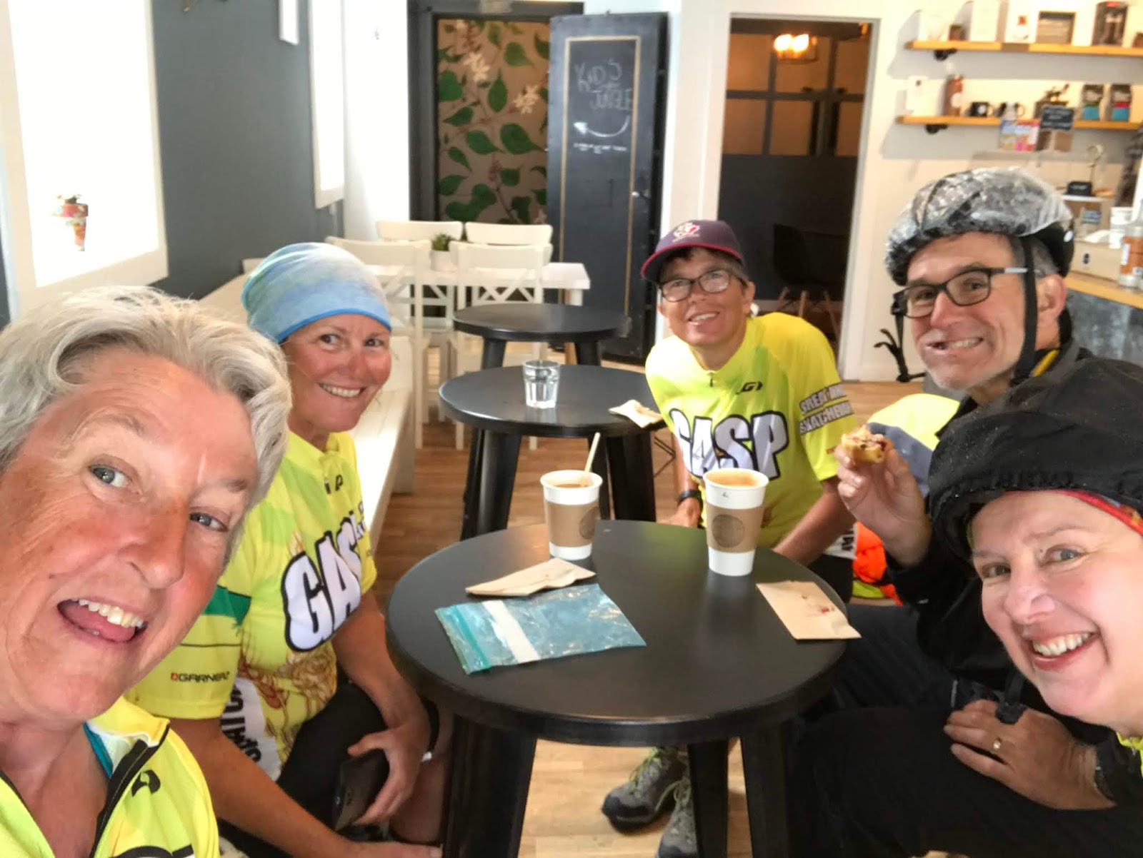
After John pulled his rig out to start his next road trip, we pulled ours out to carry on with our trip. First up for the day, was an important breakfast meeting. We met Sandy’s troop mate, Norma, and her husband, Rick, at McDonald’s for a quick visit as they were on their way to do some shopping in Fargo, North Dakota. Norma had a box of stuff for us to transport to the reunion for her. In exchange, she loaded us up with homemade cheese scones and banana muffins, as well as some cucumbers from her garden. As we were already low on the baked goods I made and brought with us, this was quite fine by me!

Winnipeg is home to the company that made Boler trailers from 1968 to 1988. The fiftieth anniversary of the Boler trailer was celebrated this August.  Over 500 Boler trailers traveled to the ‘Peg for a special jamboree of these cute little RVs.  Needless to say, we saw many of them on the highway as they made their way home from this event. As they originated in Manitoba, it is surprising how many of them we continued to see here and there, especially considering that the youngest are now 30 years old. That’s a pretty ripe old age for an RV of any sort!!


We made our way all the way to Birds Hill Provincial Park, which is just 24 kilometers northeast of Winnipeg. What a gem of a place to be so handy to the city. The 35 square kilometer park “… is a mosaic of landscapes not commonly found in such close association, such as esker ridges, dry prairie, wet meadows, bogs, and aspen-oak and mixed boreal forest communities.” It was so nice, we decided to spend three nights there and get in a coupe of days of cycling.

Even the signs are outstanding


Days 5 and 6:
On Day 5 we hopped on our bikes and rode a lap around the inside of the park before heading out onto Highway 44 to Lockport. Manitoba may be friendly, but the highways are not very cycle friendly as most of them have gravel shoulders.
Fortunately, the drivers were good about
moving way over to pass us


At Lockport, we stopped for lunch at Skinner’s World Famous Hot Dogs. Believe it or not, that was even Sandy’s idea!
Kate loves a good hot dog!

Sandy tolerating her hot dog


We hopped back on our bikes for the short trip to Lower Fort Garry national historic site.  Established by the Hudson’s Bay Company in 1830, this was a major trading post for farmers and trappers. In 1871, it also served as the site of the signing of Treat Number 1 between the First Nations and the Crown. Many of the fort’s buildings were made of stone and still stand. It is the “…oldest intact stone fur trading post still standing in North America.  Unfortunately for us, it closed three days earlier for scheduled maintenance as those old buildings need plenty of TLC.

We headed back to Lockport and stopped to check out the St Andrews Bridge and Dam.  This is a very unique structure, a camere curtain dam or movable dam. The dam and lock where built in 1907 - 1910 to enhance the river transport of goods, and provide boats with a way of traversing the rapids that were there. The dam is comprised of sections of wooden slats that are lowered to dam the river, and rolled up, like a roll top desk, to tame the mighty Red River and its nasty floods.  It is the only dam of its kind built in North America and the largest ever constructed. For more information, check out the link:

Commemorating the opening of the dam, this mural is under the bridge that goes across the dam.


We made our way back to Birds Hill, cycling along the path that parallels the Red River Floodway. Two years ago, we cycled a good portion from the south gate of the floodway, now we started this ride at the north gate.  Along the 44km total length of the floodway, there is only one point that the pathway crosses over to the other side. A floating bridge allows one to cross over, but signs warn not to do so if there is any water on the path leading to the bridge. We were in luck, all was good and we were able to cross over right at Birds Hill.

Sandy crossing the floodway


Birds Hill Provincial Park is beautiful. We would definitely go back there if the opportunity presents itself.  You may want to put it on your list of places to visit if you are in the WInnipeg area.
Sunset at Birds Hill


Day 7 and Day 8:  Birds Hill to St Malo Provincial Park

Day 7, we left Birds Hill to make our way to St. Malo Provincial Park, about an hour south of Winnipeg. 

The small community of St Malo was having its summer festival the weekend we were there. Our camp spot was right close to the lake, so we had good viewing of the night’s boat parade with all the participating boats decorated with colorful lights.  One boat had a live band that played pretty good music all evening. 

Day 8, we noticed a bluish haze in the air and a noticeable smell of smoke.  Although nothing as dramatic as in Alberta, we were surprised that the BC smoke had made it all the way to southern Manitoba! 

After spending the afternoon exploring around the area by bike, we met the campers next to us. Three sisters-in-law, Heather, Char, and Lois, stopped by to introduce themselves. After a short visit, they invited us to join them in a game of Monopoly. I am not know for my prowess at that game, but was willing to join in, none the less. Sandy opted to commentate as we embarked on the rapid play version of the game. Mark my surprise when I seemed to be doing rather well, with a pretty thick stack of Monopoly dollars in hand.  We quickly had to pack it up, however, when the town’s fireworks started. Probably a good thing, cuz no doubt my luck would have changed and my Monopoly fortune would have evaporated as quickly as it grew. 
Our campsite at St Malo    

Although it’s a very small town, St. Malo had a pretty impressive fireworks display. For an unplanned visit to this location, we certainly had a lot of pleasant surprises:  boat parade, live band, new friends, a near victory at Monopoly, and fireworks.  Our new friends recommended that we visit the Santa Maria Grotto on our way out of town. Another pleasant surprise!  The church was built in 1854.  There is a path, with stops corresponding to the stations of the cross, that takes one down to a natural amphitheater in which pews are arranged looking up towards the outdoor sanctuary and the church above.  Our friends, Jan and Rick, would certainly appreciate this inspiring place of worship if they were along on this trip.
Santa Maria Church and grotto


Stay tuned for Part 3 as we start our trek into the United States.

Thursday 23 August 2018

Kate and Sandy's Epic Road Trip, Part One

Getting Out of Edmonton

Last Tuesday, we drove southwest of Edmonton to Mulhurst Bay with the objective to cycle around Pigeon Lake.  It was a perfect day for an outing and we were enjoying a very pleasant ride.  At exactly half way around, we noticed smoke moving in, enough that soon we could not see across the lake. With almost 600 wild fires burning in British Columbia, the smoke they generate has blanketed most of Alberta. Since the smoke moved in, the air quality in Edmonton has been between 4 and 10+ on a scale of 0 - 10.  Needless to say, we don’t  like riding our bikes in such conditions.  
Smoke moving in at Pigeon Lake


With no relief in the forecast, the lingering smoky air curtailed our activity and in no time had the effect of making Sandy quite restless.  When, on Wednesday morning, we awoke to an eery sky that was orange-yellow from smoke, with a red sun, she decided that was enough.  

We had plans to leave for a month long road trip on the Labour Day weekend. With all the smoke, she suggested we leave earlier.  When I agreed, I though maybe a week earlier. Mark my surprise when she announced she wanted to leave Friday.  I managed to negotiate our departure to Saturday. That meant leaving in three days, not two weeks! With a lot of scrambling, and more than a bit of fretting on my behalf, we managed to get the dogs to camp, yard care organized, and Boxy prepped and stocked for departure on Saturday.
Is this the apocalypse?


So, what big road trip, you ask?  Sandy has her 40th RCMP troop reunion this year in Niagara Falls, Ontario. Since it’s only a further six hour drive to Columbus, Ohio, we decided we will also tack on a side trip to visit her sister, Cathy, for a few days. What the heck, I have decided to call it our Epic Road Trip.
Troop 16 Grad.  Check out back row, second from left


Kate and Sandy’s Epic Road 


Day 1:  Edmonton to Saskatoon

As I still had a few things to finish off Saturday morning, we didn’t depart our driveway until 12:01.  Rats, 2 minutes earlier and I could have made the case that we still got away in the morning.  Oh, well. Off we went with the objective to play tourist along the way as we now have an extra couple of weeks to kill before the reunion. Of course, our first tourist stop had to be at Vegreville, Alberta, to visit, once again, the world’s largest pysanka. 
Kate and the world’s largest Easter egg


As we headed east, hoping to escape the smoke, we were frustrated to find how far it extended. All the way to the eastern border of Alberta, we were still in smoke.
Smoke throughout Alberta 


If you aren’t from western Canada, you may not know that the city of Lloydminster straddles the border between Alberta and Saskatchewan. This creates a number of administrative headaches. On the medical side of things, the clinic is on the Alberta side of town, the hospital on the Saskatchewan side. This means that most of the local docs have to be licensed to practice in both provinces. Most of them aren’t happy about that.  Since licensing docs in Alberta was my responsibility while I was at the College of Physicians and Surgeons of Alberta, that meant that about every other year I would be approached by the docs, town councillors, business people, members of the provincial legislature, you name it, to make an exception and waive the requirement for an Alberta license. I stuck to my regulatory guns, as did my Saskatchewan counterpart who would face the same onslaught the alternating years, requesting that the requirement for a Saskatchewan license be waived.  It was always interesting.
Red pillars mark the border through town


Once passed the pillars, we were officially in Saskatchewan.
Welcome to Saskatchewan


At the end of the day, we checked in to the Campland RV Resort, about 10 km west of Saskatoon. Now in the flat part of Saskatchewan, this resort was wide open, unlike the campgrounds we are accustomed to in most of Alberta.  Nonetheless, it made for a very nice, quiet place to spend our first night on the road.

Day 2:
This day saw us pass through the small town of Wynyard, SK. Back in my track and field days, the Wynyard Spirits track team was a force to be reckoned with. I am surprised they produced so many talented speedsters from this small community! On top of it all, the people seem to be the epitome of nice, as this warning sign might imply.
Just “may” not “will” be prosecuted”


Our next stop was at Churchbridge, SK. Finally, we were out of the smoke! Churchbridge is a very attractive little town with lovely murals on many of the main street buildings.  The seniors’ club mural shows their sense of humour, and I just have to show you the one honoring an old time physician.
Churchbridge Evergreen Club and Seniors' Centre. 
"
We’re Only Old on the Outside"
Honouring a Respected Physician

Main Street traffic in Churchbridge


Our last stop in Saskatchewan was Esterhazy.  Esterhazy is the potash capital of the world and the  main hub of the potash industry in the province.  We really played tourist here and spent time exploring the potash interpretive centre. That was a very interesting stop, indeed. The massive potash mines are more than 3100 feet underground and operated through the use of the most modern mining techniques, machines, and systems technology.  There is even less percentage of these mines visible on the surface than is represented by the tip of an iceberg.
One of the surface operations sites.

Sandy with Potash Pete


It is just a short hop from Esterhazy to the border with Manitoba. Once across that, we were in Sandy’s home province.
Friendly Manitoba beckons
  

Not long after crossing the border, we stopped for the night at Shoal Lake.  The campground was at the site of one of the garrisons used by the North West Mounted Police during their March West. This photo is of a replica of one of the barracks from that time. It shows three types of accommodations:  the barracks for the police, a bat house just below the peak, and on the right hand side of roof of the bat house there is a bird nest.  Now that’s what I call a multi-family dwelling!


After dinner and a nice walk in the evening, we called it a night.
Sunset at Shoal Lake

That’s all for Part One of Kate and Sandy’s Epic Road Trip. Stayed tuned for Part Two in the coming week or so.


Friday 17 August 2018

G.A.S.P. Part Two

G.A.S.P. The Great Annual Saskatchewan Pedal, Part Two.  Please read GASP Part One if you haven't already done so.

Well, have we dispelled the myth of Saskatchewan being flat, yet? After day four Sandy and I had pretty much renamed this tour the Yet Another Hill! tour.

Day 5:  
Maple Creek to Cypress Hills Interprovincial Park. This was a short ride of only 39km to this park that straddles the Alberta-Saskatchewan border. Short, but of course, hilly. The last climb into the park had yet another incline of 12%!   We rewarded ourselves with a nice ice cream cone as soon as we arrived in the park.

White Tail Deer, Cypress Hill


Day 6:  Cypress Hills to Eastend 
Again, we drove Boxy to the day’s destination, this time Eastend.  Yes, I said this tour was in the south west corner of the province, so why are we going to Eastend? Eastend gets its name from its location at the east end of the Frenchman River Valley. 

As we left Eastend to ride to the midpoint to meet our buddies, we had a long climb up out of the valley. It turned out it was mostly uphill for 20km. At least the return trip would be fun. Along the way, we passed this interesting sign which we subsequently learned points to an important prairie conservation area and home to a herd of plains bison.


We met Heather, Louise, and Louise’s husband Larry about 40km out. They all decided it was time I was properly initiated into Saskatchewan cycling. Yes, it was time for me to “ride the prairie camel.” I had no idea what the heck that was, but the picture shows me in action.  I am now officially indoctrinated into their exclusive club.  Total ride distance for the day was 83km.
Kate riding a prairie camel

There are badlands in the valley, and some years ago, the world’s largest and most complete T.Rex was discovered here. Nicknamed Scotty, this find has provided a much appreciated economic boon to the region.  

We were in Eastend on a Thursday with the town preparing for “Dino Days” the coming weekend, complete with a parade and lots of activities.  Unfortunately, our schedule had us leaving town before all the festivities got underway.  A number of the riders toured the very impressive T.Rex Centre that the Royal Saskatchewan Museum has built in Eastend to showcase Scotty and all things dino.

Link:  T.Rex Centre

If there are dinosaurs, there must be badlands.  Of course, that means, you guessed it ... more hills!
Eastend badlands
White Valley, outside Eastend
Flat Saskatchewan?

Day 7:  Eastend to Gull Lake.  
This was the final day of the tour and would see us closing the loop by returning to our start point at Gull Lake. The forecast was for rain in the morning and sure enough, it stared to rain just was we were rising for the day. Boy, were we glad we didn’t have to pack up a wet tent! 

We quickly headed out to drive to Shaunavon from which we would ride back towards Eastend to meet our buddies, then ride into Shaunavon with them for breakfast. We hopped on our bikes to head out only to discover that one of the shifting cables on Sandy’s bike had decided to pack it in, leaving her with very limited gearing …not a good situation with all the hills we seemed to be encountering. But what the heck, we had just driven from Eastend and the hills on that section weren’t too dramatic, so off we went. 

Although it was sunny in Shaunavon, we knew we were headed into rain, so we donned our raincoats and hit the road. We could see the clouds approaching us and we seemed to meet all of the riders in our group except the ones we were looking to find. 

As the rain started falling, we decided our buddies must have gotten off to a late start, so we turned around to head back to Shaunavon to wait for them there. About 3km after we turned around, Sandy got a flat front tire! As she got that looked after, I watched the dark sky getting closer and we could hear thunder rumbling in the distance. We got back on our bikes and tried to get back to Shaunovan before the heavy rain caught us. No such luck. About 7km out, the rain started coming down in sheets and in no time our bikes, legs, and feet were drenched.
Riding to the storm


Once back in Shaunavon, we went into a local restaurant to look for the other cyclists to find about 10 farmers having coffee. It was pouring rain out, and we were just a little wet, to say the least. As we stood there looking like a couple of drowned rats, Sandy said, “Well, are all you farmers happy now that you’ve got some rain?!” One old guy responded, “Well, we got an inch of rain and it’s still dusty!” They all had a chuckle over that then told us a bunch of cyclists were at the coffee shop on the next block. 

We eventually met up with Heather, Louise, and Larry after they rolled into town, also pretty wet. We had a nice visit while we waited for the rain to stop. 
Escaping the rain in Shaunavon

Considering that there was a significant valley crossing on the final bit back to Gull Lake and Sandy didn’t have many gears to make the climb out, we decided to end our tour in Shaunavon and said our good-byes.  Distance for the day was 43km.

We loaded up the bikes and I hung much of our wet gear up to dry on the clothesline I created for Boxy.
 Drying wet gear

Wrapping up:  
We thoroughly enjoyed this one week tour. The scenery was fantastic and the people were terrific. For the most part, we had hot, sunny days. We all considered completing the ride to Leader into that brutal headwind a triumphal badge of honour. And it was good that the only day we rode in rain was the last day so we didn’t have to figure out how to get our shoes dry for the next day. The total distance we covered was 493kms. We had an excellent time and will never think of Saskatchewan as flat again!  
"Flat Road" really?  Not on this tour!

By the end of the week, we felt we really earned the right to wear the spectacular, official GASP jersey.  We are now confirmed “GASPers.”


We are about to embark on our next adventure, heading out with Boxy to Sandy’s 40th RCMP troop reunion.  I am sure we will discover some interesting things along the way and I look forward to posting more updates.